Claire L. Parkinson

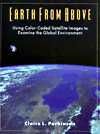
Earth from Above: Using Color-Coded Satellite Images to Examine the Global Environment (Softback) [Claire L. Parkinson - 1997]


175 pgs, 1997, University Science Books
ISBN 978-0935702415

Designed for an introductory class in Remote Sensing or of interest to the general public. This book illustrates the role satellites play in providing atmospheric data.

TABLE OF CONTENTS

    1. Introduction:Visible Images from Space
    2. Radiation
    3. Atmospheric Ozone and the Antartic Ozone Hole
    4. Polar Sea Ice
    5. Continental Snow Cover
    6. Sea Surface Temperatures and El Nino
    7. Land Vegetation
    8. Volcanoes
    9. Conclusions: Strengths and Limitations of Satellite Data

Price: $38.00
Buy Product Online | Visit Store Home


 Other Items from Parkinson

  Global Positioning System: Theory and Applications (Volumes I & II) (Hardback) [Bradford W. Parkinson and James J. Spilker Jr. (Editors) - 1996] - Bradford W. Parkinson and James J. Spilker Jr. (Editors)
  Earth from Above: Using Color-Coded Satellite Images to Examine the Global Environment (Softback) [Claire L. Parkinson - 1997] - Claire L. Parkinson


  Return To Microcosm Astronautics Books and Software


Ecommerce
E-commerce powered by MonsterCommerce shopping cart.